


The Technology Services Division is located within the Washington State Department of Transportation
and designs, programs, and implements application enhancements and modifications authorized by customers; provides production support;
fixes IT related reported problems; and maintains database integrity for over 100 WSDOT mainframe, client/server, and web-enabled applications. I'm currently
the GIS Product Support Coordinator for the department and manage GIS Software deployment and upgrades and work as a software development
project manager for several of the departments key GIS Desktop solutions, including the agencies primary data access tool - GIS Workbench.
The following list describes several projects that I have worked on over the last several years. As such, it includes projects conducted at The Carbon Dioxide Information Analysis Center (CDIAC),
Oak Ridge National Laboratory, Oak Ridge, Tennessee and at the Washington State Department of Ecology, Shorelands & Environmental Assistance Program (SEA).
The SEA program administers the state coastal zone management program and conducts basic and applied research on coastal hazards.
Research Activities
"If we knew what it was we were doing, it would not be called research,
now would it?" A. Einstein
- My Publications
- Interpretation of the Average High Water line from air photography
- Calculating Coastal Change Rates For Northwest Oregon And Southwest Washington
- Physical and Socio-Economic Indices of Coastal Vulnerability (Includes Washington)
- U.S. Coastal Hazards Database for the Gulf Coast
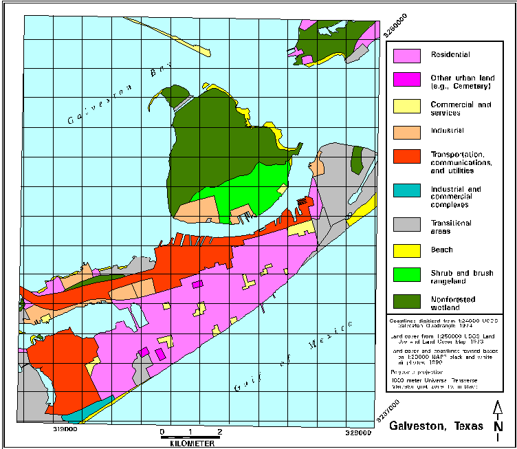
- Galveston, Texas, Sea Level Rise Case Study
- Carbon Estimates for South and Southeast Asia
- U.S. Historical Climatology Network (U.S. HCN)



Travel Images
- St. Kitts-Nevis Brimstone Hill Fortress National Park (2026)
- Point Pinos Lighthouse, Pine Grove, CA (2013)
- Great Smokey Mountains National Park (2012)
- San Diego Bay at Sunset (2010)
- Mt. Rainier out my back door (2008)
- Rich in San Diego for ESRI 2007 with the old gang from ORNL
- San Diego Convention Center for ESRI 2007
- Rich and his Bailey Bridge, put it there! (2005)
- Rich and his Bailey Bridge, good job guys!
- Rich and his Bailey Bridge, now lets see if it works
- "Bob, why don't you go down there and GPS that point while I just stand here?" in 1998
- Rich in Honduras, C.A. in 1995
- St. Kitts-Nevis Brimstone Hill Fortress National Park (1994)


Other Sites of Interest

Last Modified: October 16, 2026